Phoenix Files Maps
Warning: This page contains spoilers for the Phoenix Files series!
I have a terrible sense of geography. Given enough time, I could get lost on a straight road.
And so whenever I'm working on a story that takes place in a fictional location, I find it really helpful to draw maps for myself, to make sure I keep everything consistent when I'm writing.
Here, for the three of you who may be interested in this sort of thing, are the maps I came up with while I was writing The Phoenix Files.
Phoenix
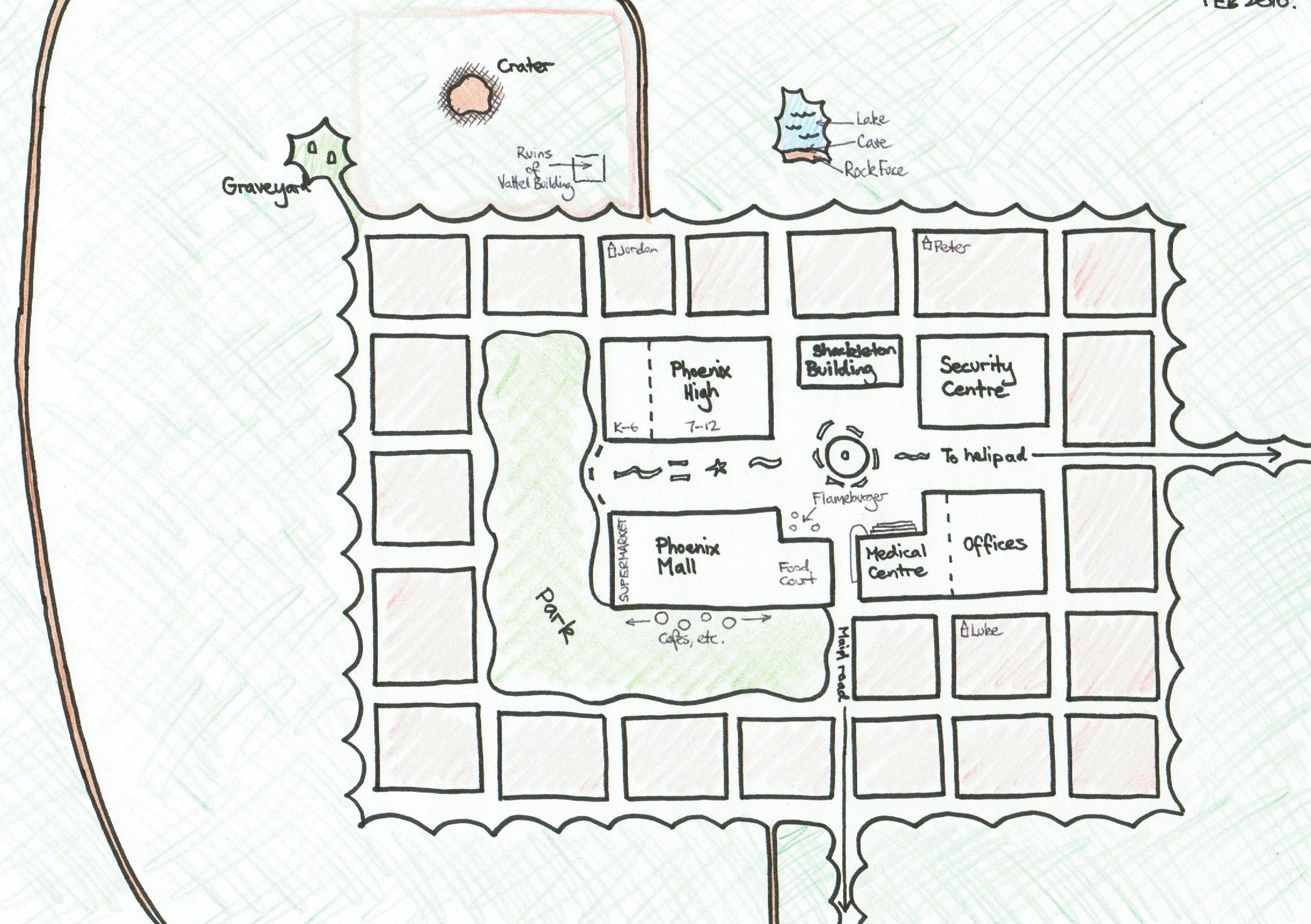
Here's a map of the town of Phoenix that I drew in 2010. I think I was writing either Mutation or Underground at the time.
It's a slightly-updated version of the original map I drew back in 2008, and I must have been seriously procrastinating on whatever day this was, because check out how pretty my colouring in is!
Phoenix High School
Phoenix High is a hybrid of two real-world schools. The top-left and bottom-right sections are based on my memories of my old high school, and the top-right section is based on the school where I teach. (The sports field on the bottom-left is my own creation. I invented that green rectangle all by myself. This is why they pay me the big bucks.)

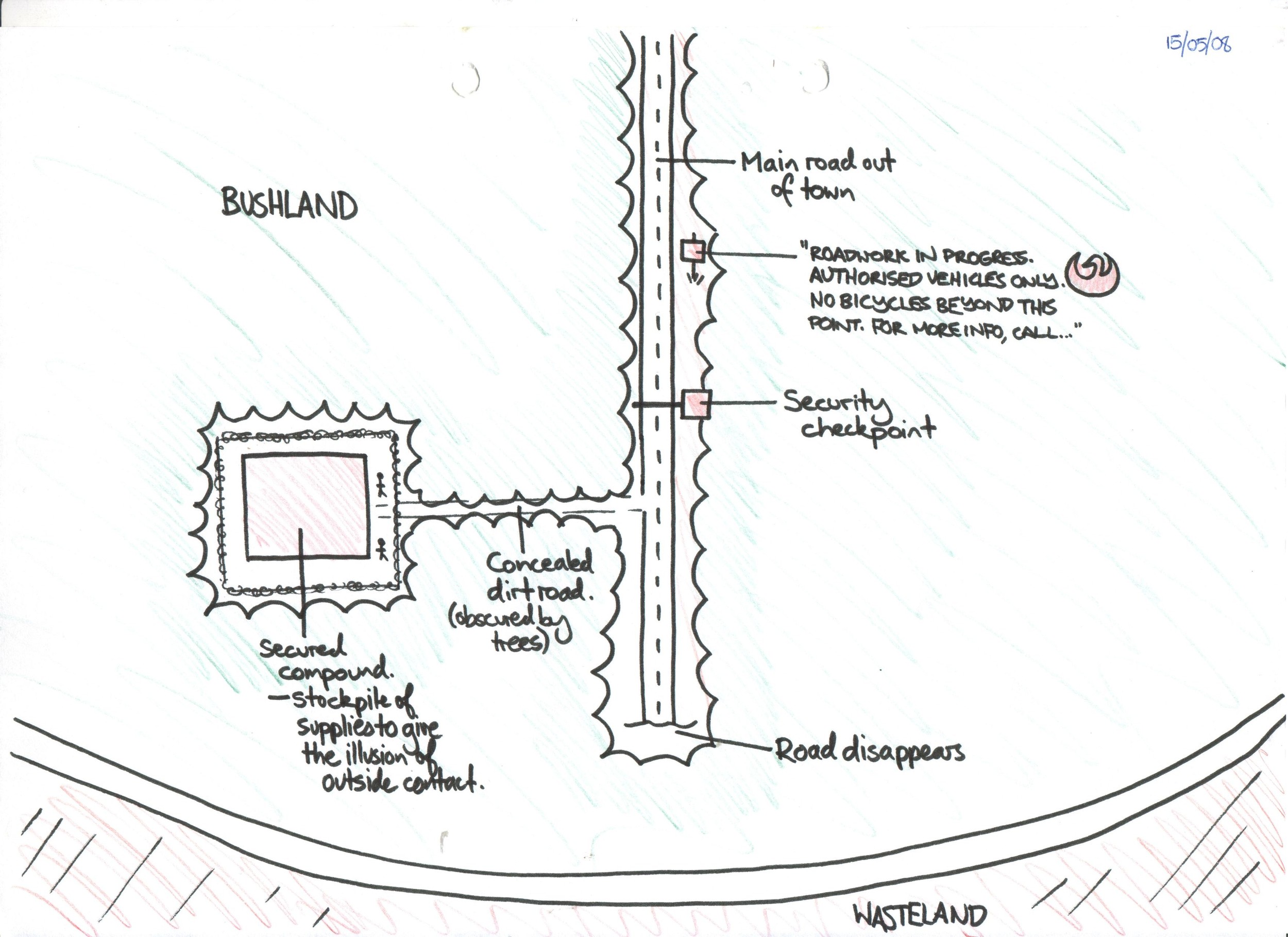
The Road out of town
Here's a map showing the path that Luke, Peter and Jordan take to the wall at the end of Arrival.
I'm not sure what was so complicated about this part of the book that I felt like I needed to draw a whole other map... but here we are.
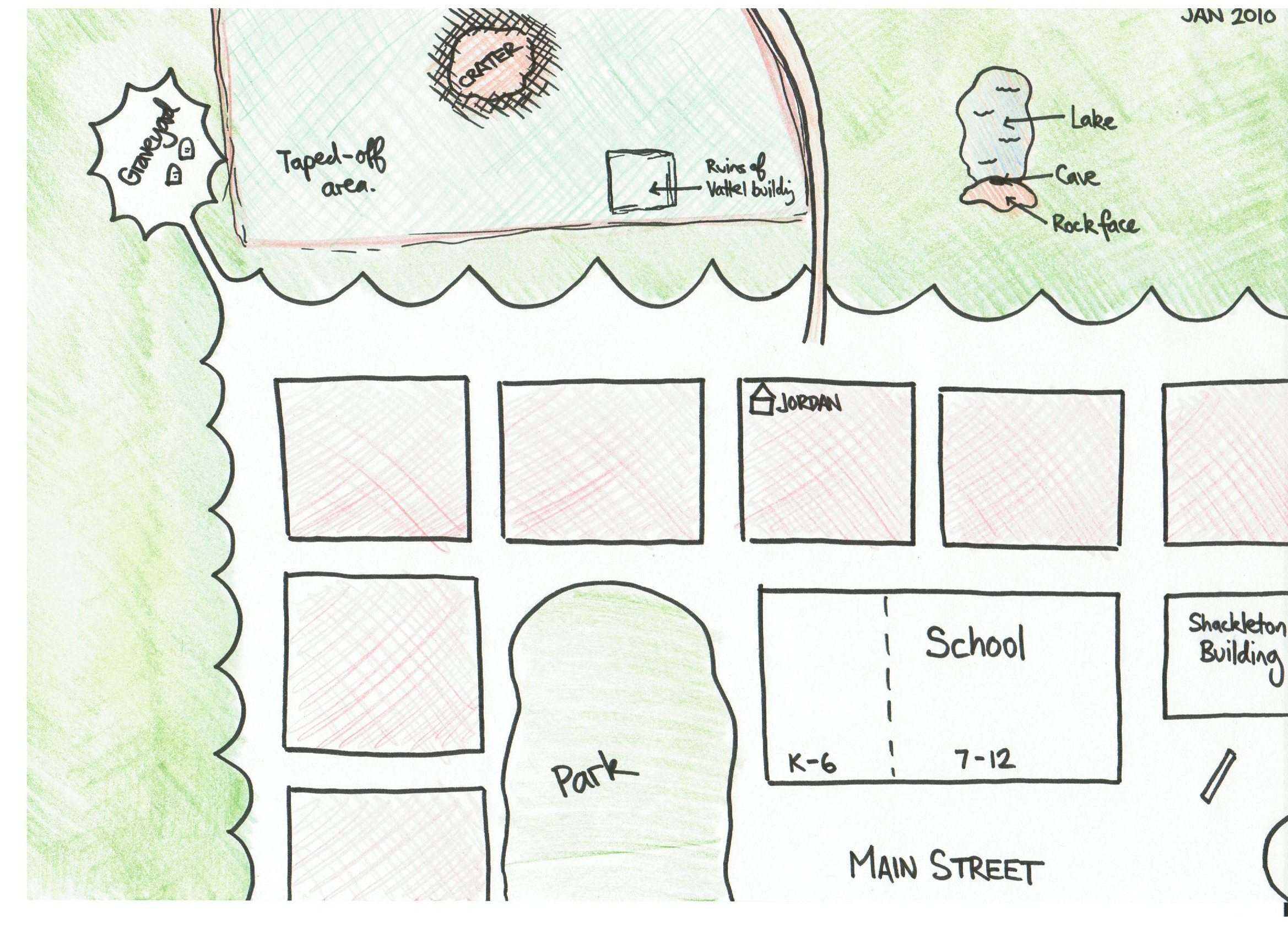
The Vattel Complex (Part 1)
Here's a zoomed-in bit of Phoenix, showing the hidden entrance to the Vattel Complex...
The Vattel Complex (Part 2)
...and here's an overlay showing how the Vattel Complex maps onto the town above.
That's right! Apparently, at some point in the writing process, I became obsessed enough with accuracy to break out the tracing paper...
